Add Tropical cyclone third party data to the map layer
Add third-party data from different sources to the map layers. You can use the layer as a spatial filter while searching for events.
Third party data includes external advisory data
from NOAA for multiple years andESRI Global Tropical Cyclone
Layers.
Procedure
-
Click on the add symbol next to TROPICAL CYCLONE

-
Click on either
- Global Tropical Cyclone Layers or
- NOAA Advisory 2023 or
- NOAA Advisory 2024
we have retired NOAA Advisory 2022 data from this release.ADD RESOURCE DATA window opens enabling you to Select Vendor based on the data you want to explore. -
From the Select Vendor drop-down list, select the
advisory data you want to include in the map layer, for example, NOAA Advisory
2024.
Various events listed with the selected advisory will appear on the screen for your selection.
-
Select the event of your choice from the list. Alternatively, you can search by
entering the event name in the text box.
You can view the selected event on the data panel grouped by the date when the advisories were released. You can view the last updated advisory time stamp below the event name.
-
Click on the advisory update date of your choice.
You can view the expanded list of all advisory layers for the selected date.
-
Locate the advisory layer to add and click on the Add to Map
.
 .
The selected layer from the advisory catalog appears on the map.In case of trouble retrieving NOAA advisory results, the Verisk Catalog Viewer will replace the list of available layers within the selected advisory layer with an error message that the service is currently unavailable.
- Optionally, click on View Details to get specific peril-related information on the various listed storms.
-
Optionally, repeat steps 2 to 4 to add multiple advisories to the map
layers.
On selecting Global Tropical Cyclone Layers, click on Get Updates for latest set of results
 .
.
Results
The advisory data gets added to the map layers for visualization. You can view the storm track, hourly points, and cone of uncertainty and use this layer as a spatial filter for your event search.
Next Steps
 to get back to the main search
window.
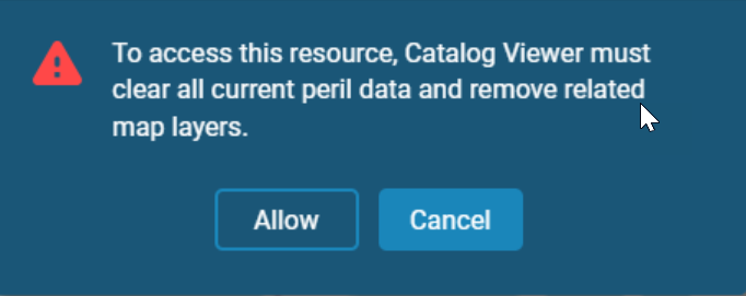
Note: Note that whenever you navigate from one peril search to
another, you will receive a warning message informing you that all of your current peril
data and related map layers will be cleared. 

